
Rec/Cyan 3D glasses are needed for this post. There are a few 2D photos; I’ll mention them when they come up.
Big news last week!
… or maybe not so big- I had been waiting for the announcement to post this, checking news websites daily, and still missed it. Anyways, the road from Inuvik to Tuktoyaktuk was finally completed; now there is an all season road to Canada’s Arctic coast. A tourist can now drive to all three oceans bordering Canada.
Before the road was built, an ice road connected Inuvik and Tuktoyaktuk during the winter, with no road access in summer. I had always wanted to see the Arctic coast, so while in Inuvik, at the end of the Dempster Highway, I took a day tour there. This was in August, so no ice road(although there was some snowfall and temperatures of -5 at night). I instead flew in to Tuktoyaktuk on a small plane and took a boat back up the Mackenzie delta to return to Inuvik.
Despite being so far north, Inuvik is still forested, mostly by small black spruce trees. I had been told that the Mackenzie River warms the region slightly, pushing the permafrost further underground and giving some trees an opportunity to grow.
When flying from Inuvik to Tuktoyaktuk, you can see the trees become smaller and more sparse; eventually the terrain turns into tundra. The permafrost prevents liquid water from draining, resulting in hundreds of small lakes and ponds.

There are strange land formations caused by the permafrost, including ice wedges caused by the expansion and contraction of the ice through the seasons(2D photo).
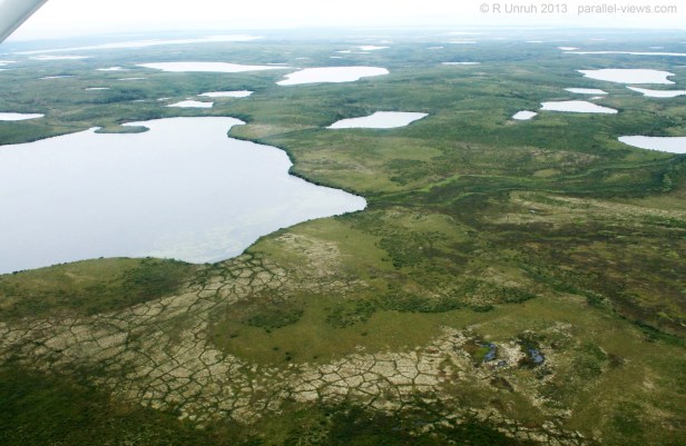
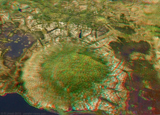
There are also pingos, small(and some not so small) hills caused by rising and expanding permafrost(2D photo).

The above photo is of one of the pingos in Pingo National Landmark, as seen from Tuktoyaktuk. A National Landmark is an obsolete Canadian park designation (it seems like it was intended to be similar to the USA’s National Monuments system). Pingo National Landmark was the first and only location given the designation; the law allowing for National Landmarks expired in 1994.
On the flight to Tuktoyaktuk, we flew over several other pingos and ice wedges, often next to one another.
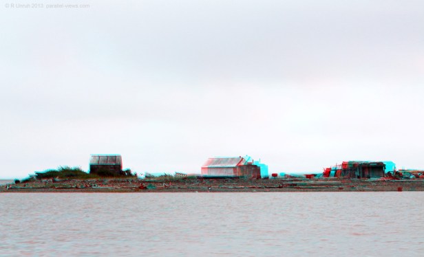
Tuktoyaktuk is an Anglicization of an Inuit name, meaning ‘resembling a caribou’. It is a small community near the mouth of the Mackenzie River, on the Beaufort Sea. the town has about 900 people.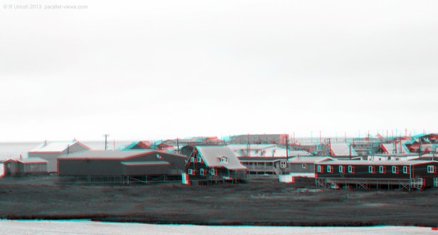
Other than the Pingos, the land here is very flat. Although it is too far north for trees, logs that have floated for hundreds of kilometres down the Mackenzie River are washed up along the shoreline.

The northern monument to the Trans-Canada Trail is in Tuktoyaktuk, as it is the northern terminus for the trail(which is officially a river route in this section, although that might change with the new road).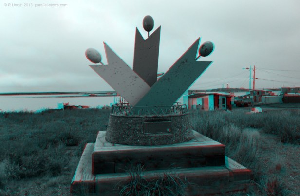
After a short tour around the town(shorter than planned- a major arctic storm was coming in), I boarded the boat, and headed back to Inuvik. I had one last look at Tuktoyaktuk…
Then the boat left the town and went back into the Mackenzie River delta.
