Happy National Aboriginal Day!… or not… I had been preparing this to be ready on the 22nd, but got called into work. I’m not promising to be back on track with this blog; between a busy work schedule and other projects(and my general tendency to procrastinate), it’s been hard to find time to write here, but I’m not planning to quit. Anyways, In honor of the day I missed, lets look at… England!

No, not really. How about Saskatchewan, which is almost the same as England. They both have places named after queens, and they both have farms and rivers… what else do you need?
Wanuskewin Heritage Park is beside Saskatoon, in the centre of the province of Saskatchewan. It lies along the South Saskatchewan River. The site has been used by the first nations(The Northern Plains indigenous groups) of the province for over 6000 years. Gilgamesh? Who’s that? One of those Johnny-come-lately kings?
I visited it in mid-April, before the plants started growing. It was a cloudy day, so the pictures aren’t spectacular, but it is an interesting site regardless.
There is a small valley with a creek that flows into the river; this valley was regularly used as a campsite, according to the archaeological record. There were several reasons for this; it offered protection from the wind and… actually, for anyone who experienced a prairie winter, there isn’t any need to give other reasons it was used. Saskatchewan in the winter is a perfect example of how to properly use the term ‘windchill’, and I expect to warm up from my visit to the province any month now.
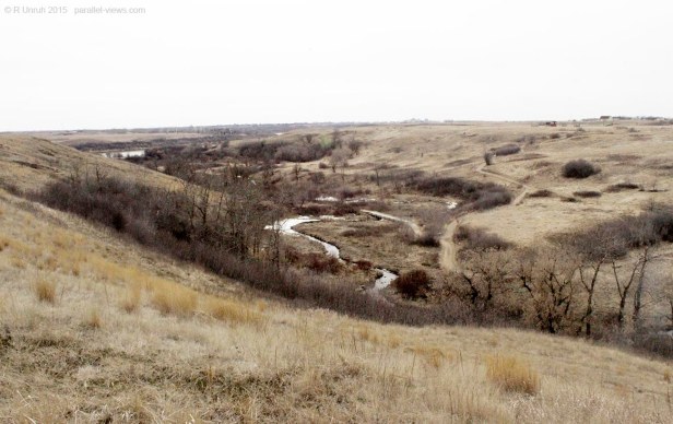
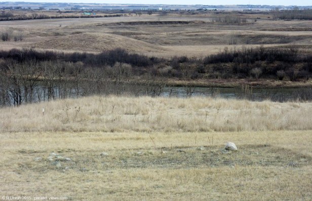
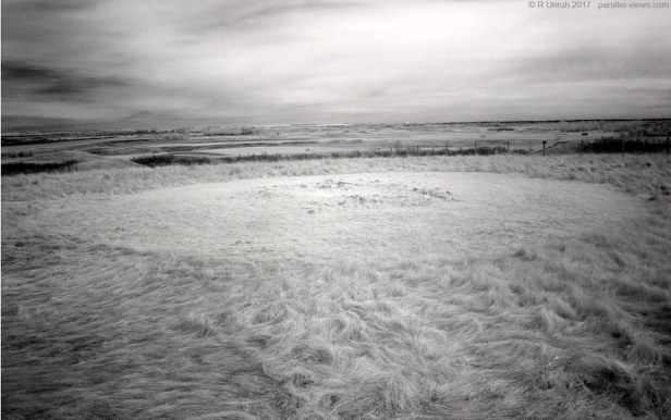
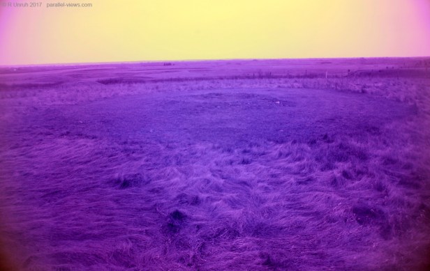
Here’s the valley from another angle.


Other than the colour, there isn’t much of a difference between the two photos above; the structure of the clouds has a bit more definition, and that’s about it.
The First Nations of the plains were largely nomadic, so there aren’t many permanent structures. As a result, the park is best experienced with a guided tour, as there are not many obvious signs of habitation or use. To get the most of the park, it is great to let a professional tell you if the rock is just a rock, or is part of something with more historical value.
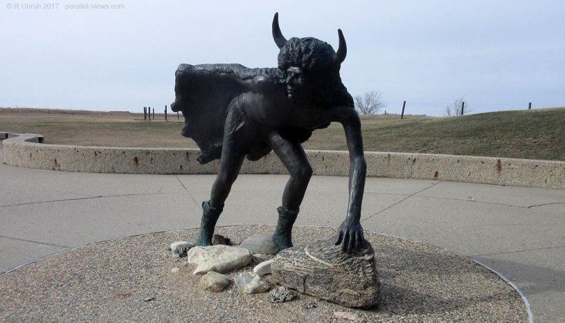
There are also traces of bison corrals and jumps; the slope for the jump isn’t as dramatic as Head-Smashed-In Buffalo Jump, but is still a steep enough slope to prove that bison can’t skydive. They’re bringing bison back to the site, so… maybe keep away from the bottom of any cliffs.
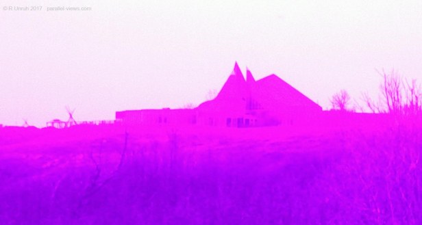
The best developed sign of habitation is… well, if I’m getting technical, it is the visitor and interpretive center. It is a very interesting design, but I wouldn’t really call it a major draw for tourism.
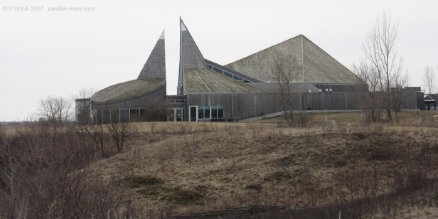
However, If I use my short band pass filter, without adjusting the white balance, it does look like it belongs on an album cover.
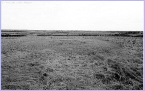
If we’re talking about archaeological remnants, it would be the medicine wheel, only about 1500 years old. That’s fairly recent in the long history of the region. It is off limits, but there is a good lookout beside it, and benches to sit on.

The medicine wheel is the northernmost one found so far; that doesn’t mean that there weren’t any found farther north, but others could have been destroyed by development, or just not discovered yet.
The formation is clearly a ring, as seen when zoomed farther out. With the lookout, I had a stable place to look outside the visible spectrum. Again, here it is in visible:

And of course, I can divide the visible spectrum into the blue…
…green…
…and red channels. 
The shortest wavelengths in the visible spectrum(blue) are best at showing the feature, in my opinion; the lighter foliage in green and red make it more difficult to distinguish. So, outside the visible spectrum, I’ll start with the longer wavelengths, and move into the shorter ones.
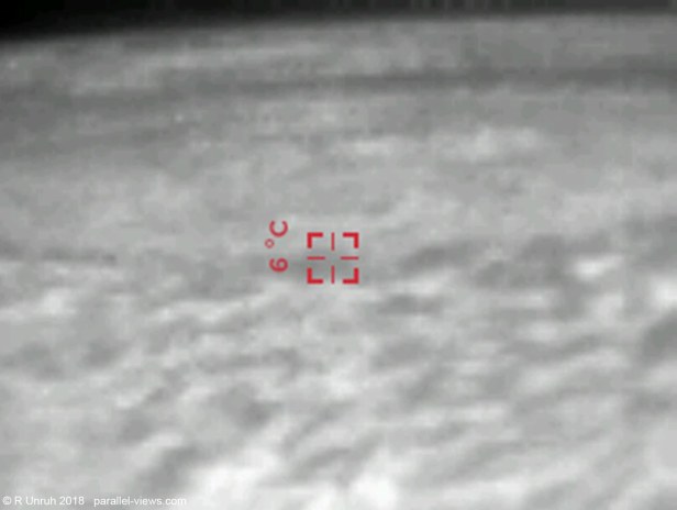
… well, that certainly is a photo. I think… maybe… or I could have photographed some static off the television. I’m honestly not sure what I could have expected; it was a cloudy day in spring, so there likely wouldn’t be much temperature variation.
On to something closer to the visible spectrum.
In the 950 nm range, the Medicine wheel is actually fairly well defined. The rocks and uncut grass are darker than the mown grasses. The clouds also have their clearest definition in this wavelength.

At 760 nm, the photo is fairly similar; the clouds don’t have the same contrast, and there is a touch of colour, but there isn’t much difference than at 950 nm.

With the UG11, the landscape looks fairly similar to the visible spectrum. The medicine wheel is still easier to distinguish from the grasses.
With my homemeade short pass filter, the photo looks…
… awful. It just looks awful. For every time I take a good photo with no white balancing, there are a dozen times where it is borderline unsuable. With the white balancing, however…
It still isn’t as clear as the other photos, but at least the landscape can be distinguished. I couldn’t set the white balance any better than this, which is normal for this filter.
Finally, ultraviolet.

The sky is so bright that it looks hazy in the UV spectrum; the light seems to be scattered in all directions. The land itself is too dark to see the rocks well; this is the best I could do with the contrast. This photo also has the least contrast between the types of foliage; while some of the brush was dark in the other photos, it looks almost the same here.
The park is on Canada’s list for potential UNESCO World Heritage Sites. Perhaps it will get official recognition and become part of the list in the next couple years, in which case, I’ll have to alter the categories for this post. Still, though, I’ll be able to say ‘I was there before it was famous’. Let this post be my proof that I visited the site early, only missing the first 99.97% of Wanuskewin’s existence.
The above photos were taken with a modified Canon Rebel T3i camera
