I don’t usually post my photos in chronological order, or geographical order, or any kind of order actually(unless you count ‘what will amuse me next’ as an order, WHICH I DO), and I actually had another idea for this post(I’m trying to do these at least twice a month for now, but we’ll see how long that lasts). Last time I wrote, I had an error of judgment: I mentioned last time that I had visited a place. A shrouded and mysterious place. And I think that if I posted anything else, all my thousands hundreds of fans would be annoyed that I didn’t delve deeper into this land of legend first. So, yes, I’ll follow up. No, it wasn’t a joke, Yes, the rumours are true, and YES, I did visit Illinois.
Have you ever mentioned that to someone? Try it. Once, I mentioned that I had passed through Illinois. This was at my last dinner party. All conversation stopped. The ladies all gasped and dropped whatever they were holding. The men ushered me out of the room, saying that I was ‘upsetting the womenfolk’, but I noticed that they were trembling as they closed the door on me. Months later, children still run screaming from me, and my neighbours avert their eyes as I pass by.
And who could blame them? Illinois… a land of ancient, desolate ruins and unearthly pyramids, with only a small village or two eking out a meagre existence. Truly, this is a wild and primitive frontier.
So, of course as a daring and intrepid explorer, my goal was to visit those very same desolate ruins and unearthly pyramids, as long as I didn’t have to walk too far from my car and could go to a restaurant after a I explored. And I did exactly that. Here’s the thing: although those strange and deluded Illinois apologists might claim that I used a little touch of hyperbole in describing the state, I’m not lying about that part. Ancient ruins and pyramids… of course I’m talking about the Cahokia Mounds.
Cahokia Mounds State Park is near the western border of the state. At first glance, it just looks like a well maintained field with a few mounds on it. That isn’t inaccurate.

Cahokia has the same issue with it’s history as many of the archaeological sites around my area of Northern BC(and in fact for sites across much of Canada and the USA): The structures may have been impressive, but they were built of wood, and built in a climate that isn’t great at preserving wood. The structures themselves are long gone, either from natural decay or from the materials being reused by the native population. Still, the flattened terrain and manmade mounds suggest a history to the area, and archaeological excavations have shown how impressive it was. A sign by the parking lot illustrates how it might have looked in its heyday.
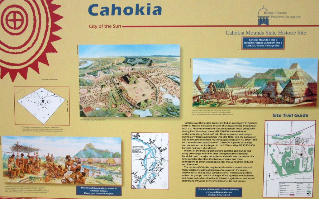
By a complete coincidence, it sums up the site’s history much better than I could, but in case you don’t want to read microscopic text, the area was first inhabited around the 8th century. It reached its peak around the 1000-1100s, with between 10 000-20 000 residents.
….which in my mind means that I should probably be calling it a city.
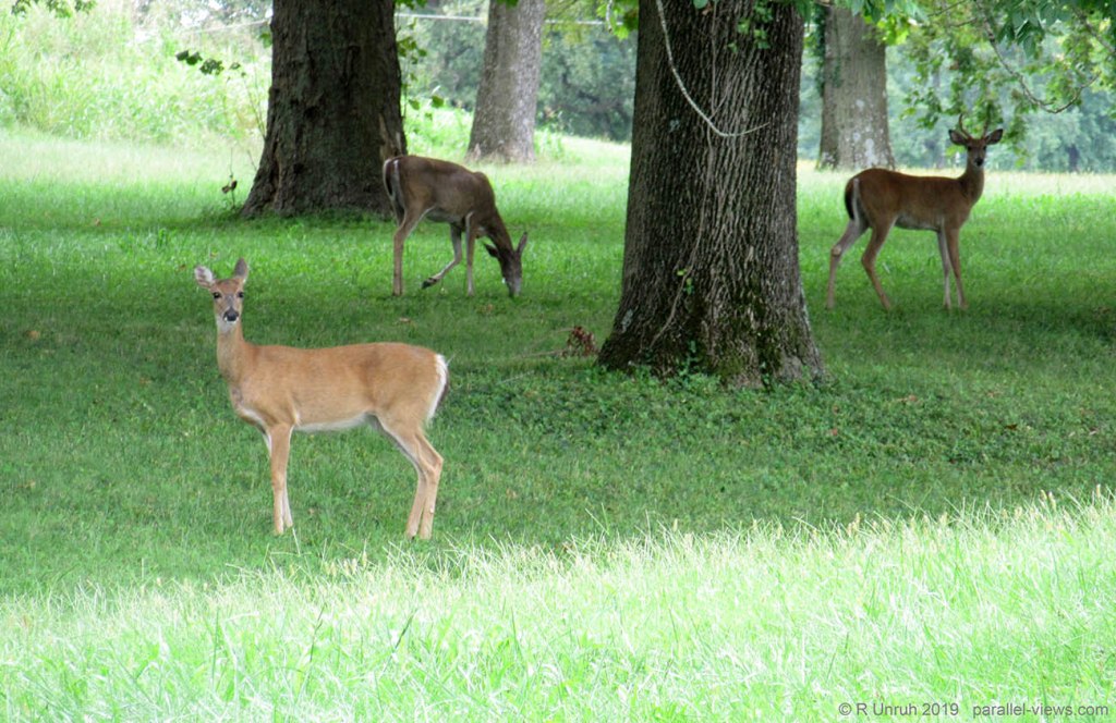
The city declined after that, being abandoned during the 1300s. 700 years later, and nothing remains other than some earthen mounds. The only inhabitants within the park now are the deer.
The park doesn’t encompass the city in its entirety; it only covers and protects what would have been the centre of it. The outskirts are still privately owned, and modern homes and buildings exist there. Still, descriing it as a ruined ancient city, inhabited by wildlife, sounds much better.
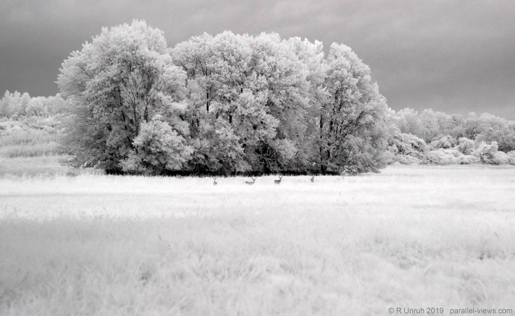
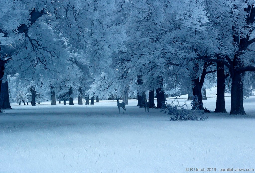
Actually, lets look at the deer some more.
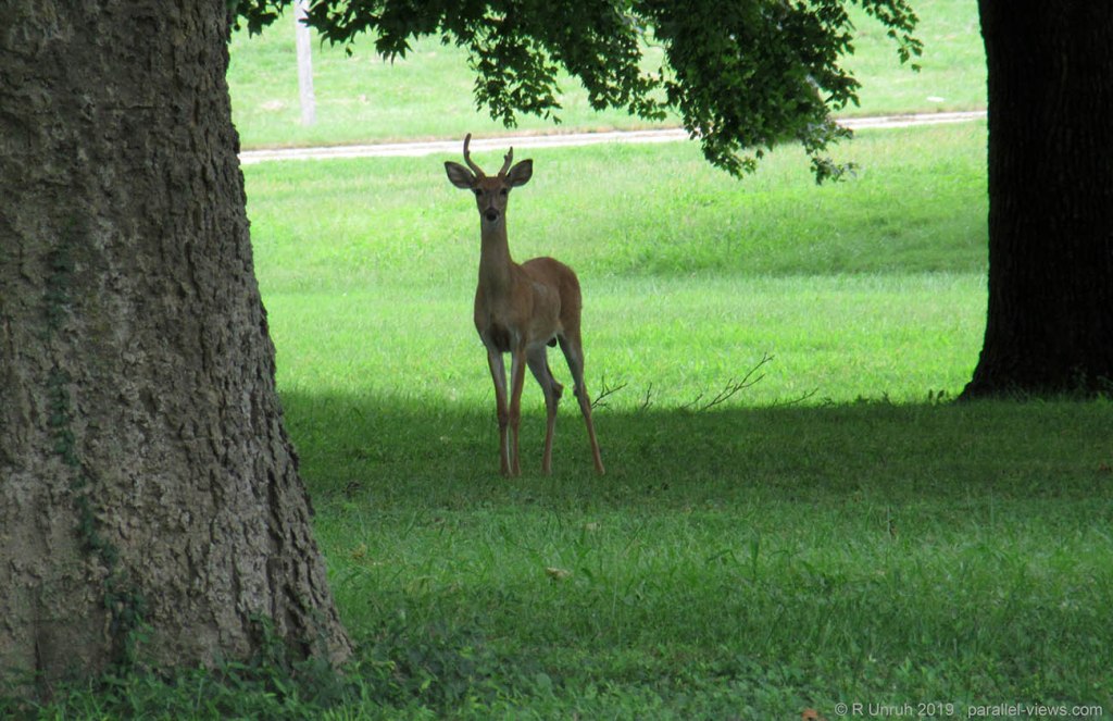
I thought deer were good at hiding. So much for camouflage. Maybe their coat looks less obtrusive in the forest, but they really don’t blend in too well with an empty field, do they?
But maybe they do in….
….
…
…
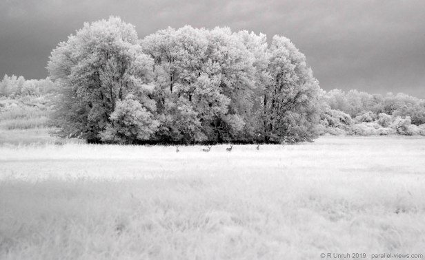
INFRARED!!!
… nope.
As it was cloudy, I had my fixed zoom lens on my full spectrum camera. There’s a clear tradeoff: I lose the ability to zoom, in exchange for an ability to take quicker photos in dimmer light. If I am going to explore the ultraviolet range, I need that. Spoiler: I didn’t explore the ultraviolet range.
Anyways, those are the same deer as before, but I couldn’t zoom in. Instead, using my years of knowledge about digital media, I can just give the commands: COMPUTER. ENHANCE.
The computer didn’t enhance. Okay, I’ll just crop it instead… by myself… like a caveman….

You know, computer, I bet the builders of this city had computers that could ENHANCE when I asked them to. I mean there’s some I could try online, but I’d have to pay money for them. You should just do it.
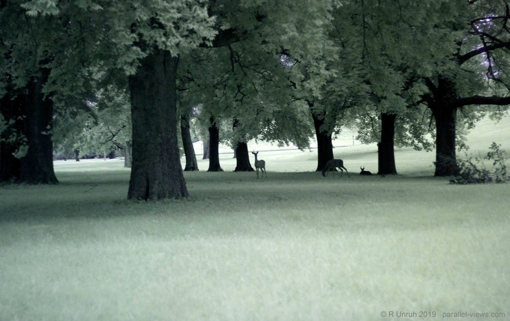
Well, if infrared doesn’t camouflage the deer, maybe ultraviolet will? Except, as mentioned, I didn’t take any ultraviolet, so… dual infrared/ultraviolet, I guess?

COMPUTER! ENHANCE!
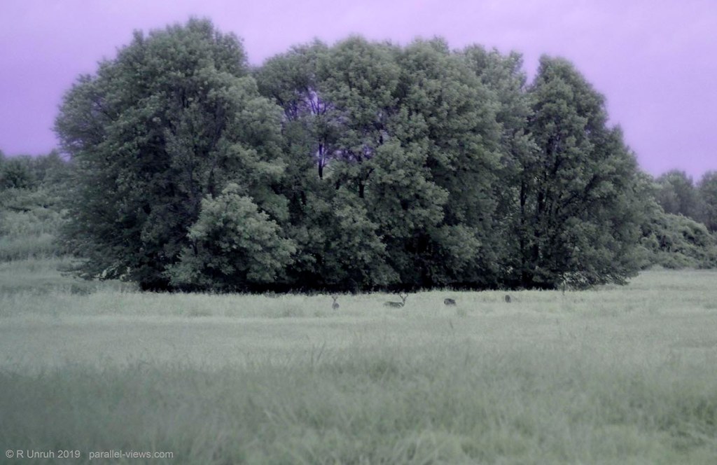
Oh right… that didn’t work before. Okay, I’ll be right back… just need to do some cropping.

With the cloudy weather and the long exposure, the photo was a little blurry cropped to this level. Blurry enough to hide the deer? Not a bit.
Okay, enough about the deer and their failed camouflage. Lets talk about the city. As I mentioned, the pyramid is…
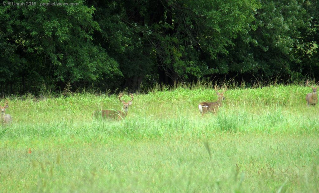
You know what? NO. I’m not going to let those stupid deer off so easily. They’re supposed to be hidden. Just because they’re in a protected park doesn’t mean they can slack off. They might be hidden in the brush, but it’s hard to take photos in the brush. Besides, Whoever heard of dense brush in the forest?
How about a well maintained forest? That’s the BEST kind of forest.
Okay, not hidden in visible. How about near-infrared?
That’s even less hidden than an empty field? ARE THEY EVEN TRYING? IS THERE ANY POINT DOING DUAL BAND?
No, there is not.
Okay. Enough about the stupid obvious deer. They annoy me too much. Lets go on to the pyramid.
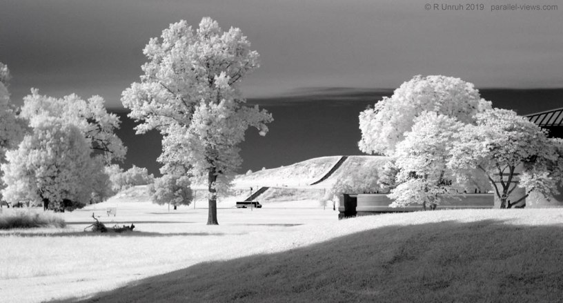
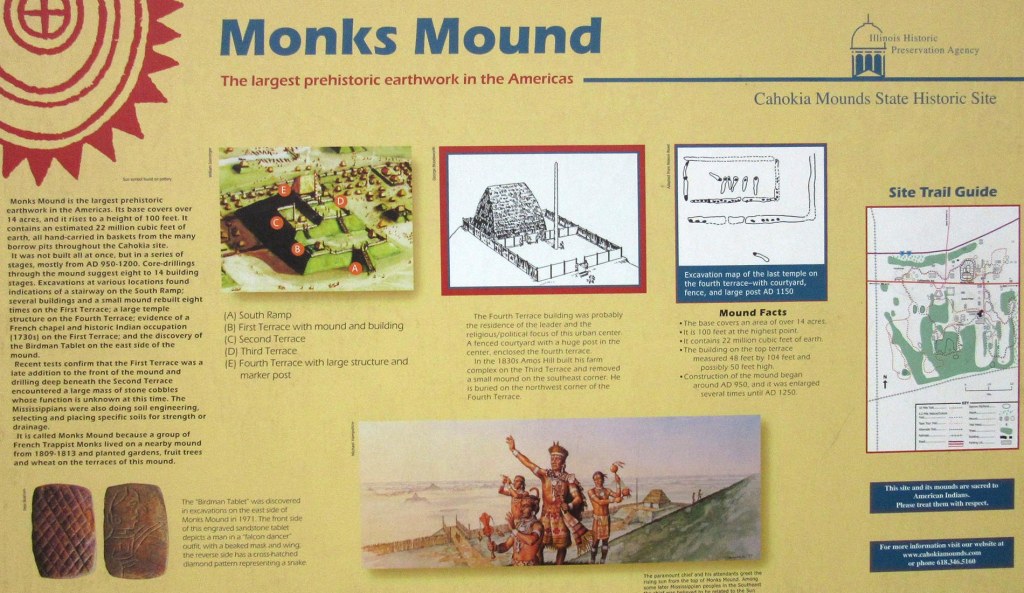
The Monks Mound is the largest pyramid north of Mexico, and the base covers a larger area than the Great Pyramid of Giza(about 6 hectares vs 5.3 hectares). However, it isn’t as well known as the Central American or Egyptian Pyramids. I think a good reason for that is the construction materials. Instead of stone blocks, the pyramid was composed of soil and gravel. On the face of it, that isn’t as impressive. However, it isn’t just a big pile of dirt… it’s a really big pile of dirt. The mound is composed from about 700 000 cubic metres(25 000 000 cubic feet) of soil, rising a hundred feet over the landscape. Even if was just moved into a big featureless pile, the social network needed points to a more complex culture than you might think. Workers would have to devote their time to hauling dirt, gravel, and sod, which means that they would have had to have been supplied with enough necessities for themselves and their families while they build the mound.
The informational sign shows how archaeologists assumed that the Monks mound looked 800 years ago:
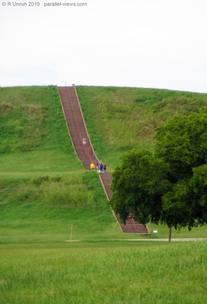
800 years later and the wooden structures are all gone. The mound itself has slumped and settled, making the terraces less obvious. There’s still the staircase…
…it’s new, though, not the original. Probably it was decided that building a new stairway might impact the integrity of the site, but a lot less than thousands of tourists deciding to climb the steep slope to say they made it to the top.
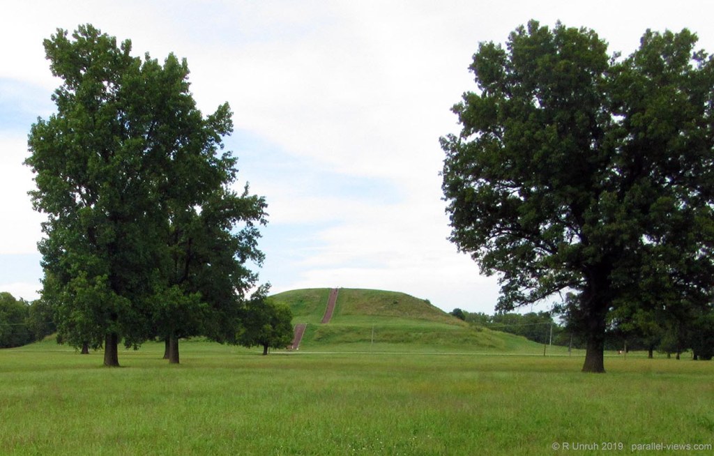
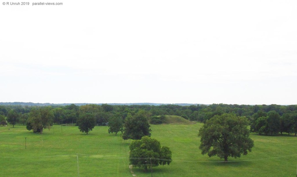
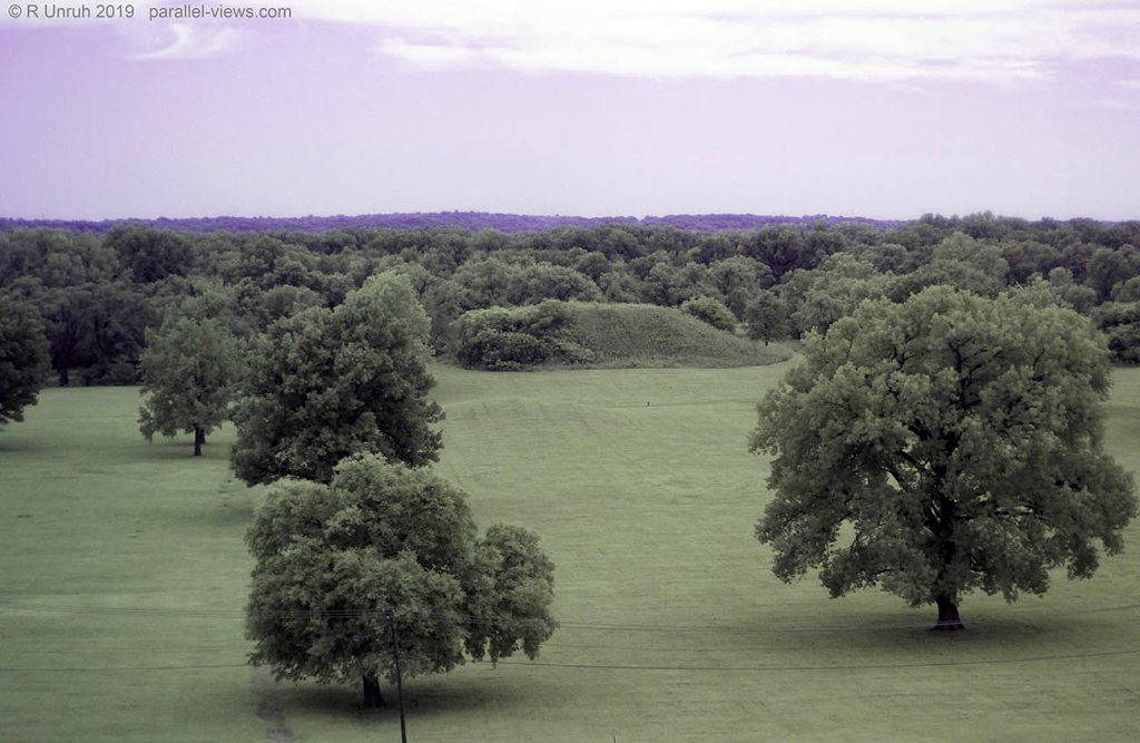
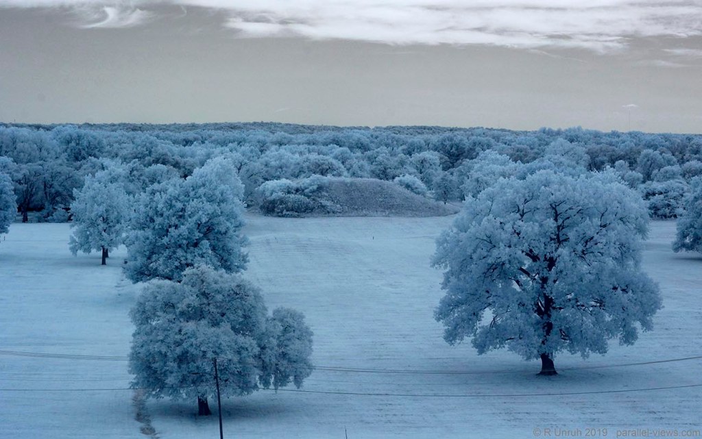
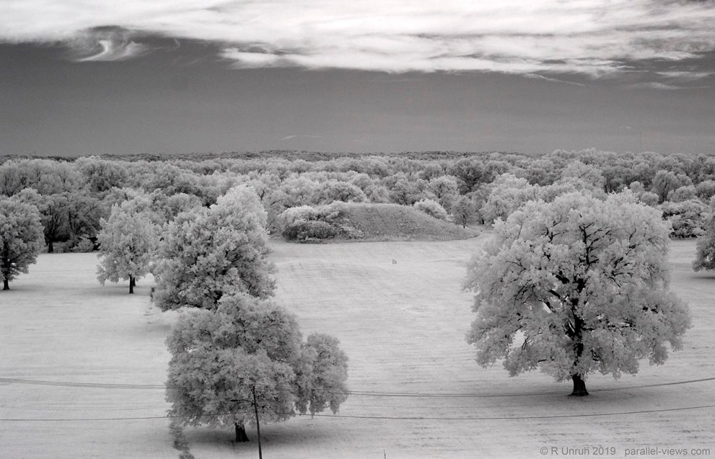
This was the best angle to see the entire mound, from what I could tell. It was also quiet enough that I could play around with my lenses and filters.
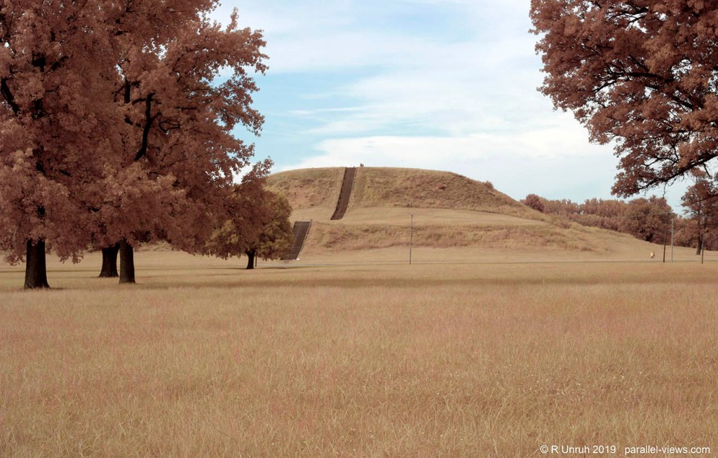
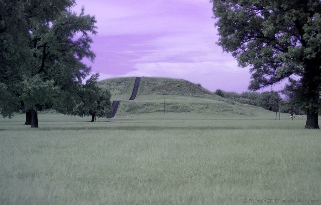
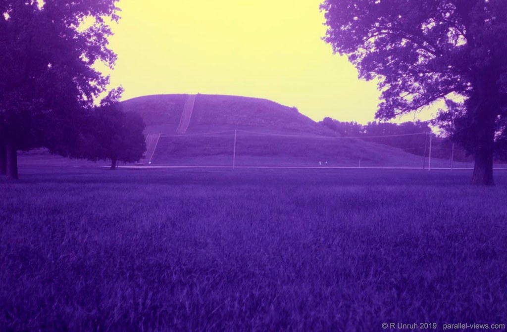
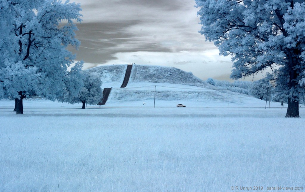
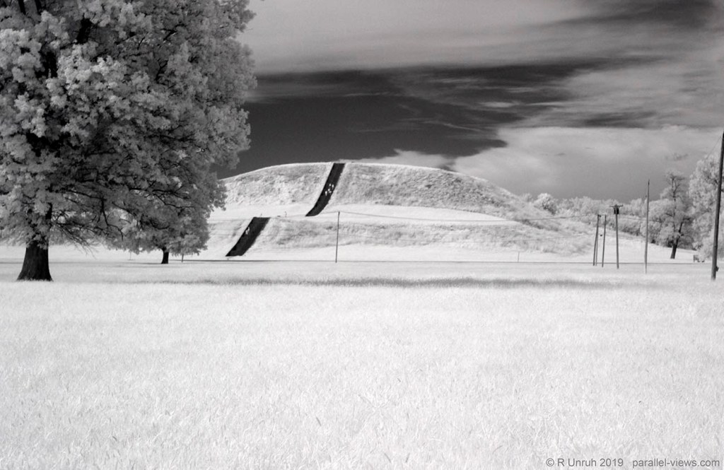
I usually talk about each photo at a time, but really couldn’t think about much to say about them. The dying vegetation on the steeper part of the slope is most noticeable in dual band and 680 nm, but that’s about it. Walking around a bit more gave me a chance to also try a thermal infrared photo. Okay, ‘gave me a chance’ was more ‘gave me time to remember that I had another camera with me, but I was too lazy to go back to where I took the other photos’, but that’s all semantics. The mound from another angle:

It’s cloudy in these photos, so you only have my word for it, but the sun would have been behind me while I was taking the photos. The cloud didn’t entirely diffuse the sun’s heat. The trees are slightly warmer from the angle of the sunlight, but the ground temperature is fairly uniform. The staircase, with its darker materials, has absorbed a lot of heat, and is the brightest object in the picture.
I did climb up the 154-step stairway, like the intrepid explorer that I am, and courageously made it to the top after almost passing out from the exertion and the lack of air conditioning, like any other intrepid explorer. After almost throwing up, as intrepid explorers do, I had an excellent view of the park.
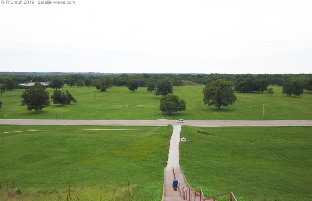
Western Illinois really is flat, isn’t it?
The interpretive centre is the only modern building in the park, on the left. That is an active road through the parkway; it doesn’t just lead to the visitor centre. In fact, the interstate is behind me, and I could hear a lot of traffic from the top. It could be all of the cars car passing by in the photo, but I suspect it is the interstate. The road is called Collinsville Road, just to prove that I did do some research.
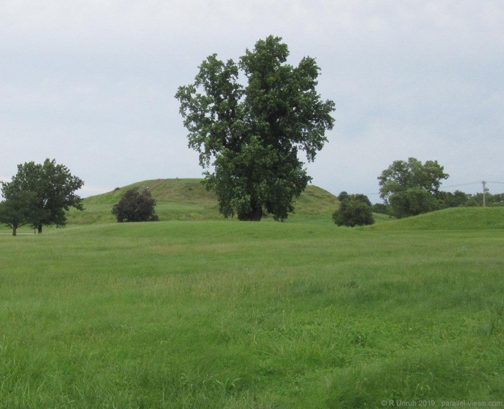
As shown from the photo, The Monks Mound isn’t the only mound surviving in the park; just the biggest. There are 81 mounds listed on the park website. Some are obvious, some are only a shallow rise in the fiedl, and some are only known from historical maps of the area, and are long gone.
Zooming in on the above photo:
The large mound is Mound 60, the Fox Mound. Beside it, but hidden by the trees, is Mound 59, which is cone shaped. In different spectra:
Again, I like the photos, but nothing really stands out in the different spectra. All the interesting stuff is underground, and most historic sites frown on yo coming with a shovel.
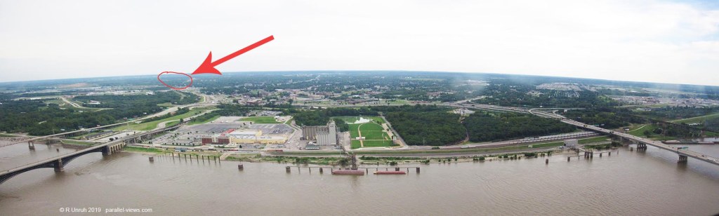
I’d mentioned before that Cahokia Mounds was close to the Missouri border, but looking around from the top of Monks Mound, it becomes clear just how close it is.

There’s the city of Saint Louis. It’s slightly hazy, but it’s clear. There’s some weird arch-ey looking thing there… maybe some intrepid explorer should explore it. The bridge in the centre would be crossing the Mississippi River.
If… I mean this completely hypothetically, but IF some brave adventurer were able to scale that… lets call name it ‘Gateway Arch’, and again, this is all hypothetical, who knows how you could even get to the top… Cahokia Mounds State Historic Site would be about here:
But how does Saint Louis look from the top of Monks Mound? …Well, I already posted a photo above. Did anyone notice it? It’s right up there. Or maybe you mean outside of the visible spectrum?

It seems to be something I mention all to often, but haze is worse in the shorter wavelengths. In this case, it’s responsible for the purple tint to the sky and city, as that is the effect of the ultraviolet wavelengths. the city would probably be much clearer in pure infrared.

It’s clearer, alright. It’s also almost entirely black. I didn’t expect that. A black city, surrounded by blue trees, viewed from atop an ancient ruined pyramid… I’m writing Lord of the Rings fanfiction again, aren’t I? The ‘blue trees’ sounds a little off though… let me try again.
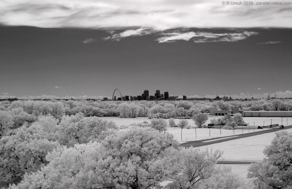
… A black city, surrounded by bone-white trees…much better!
That’s the best of my multispectral photos from Cahokia Mounds. I’ll look at my 3D photos next time, and write a bit more about the Monks Mound. For now, though, it is time for me to intrepidly explore the television.
The above visible photos were taken with a Canon SX600 HS camera. The thermal camera used was Seek CompactPRO; other spectral photos were taken with a modified Canon Rebel T3i camera.
