

Well hello again! How are you?… good, good…
How was your long weekend? Yeah, yeah… I cancelled my plans due to storms.
The last one, however? July 1st was Canada Day, July 4th Independence day, so there was a long weekend on both sides of the border this year. I’m sure some other countries had holidays too. Did you do anything?
…. good, good….
Yes…
… reealllly? …Isn’t that illegal?
…yes, of course…
…Well, I’m sure they’ll grow back. And if not, she doesn’t need BOTH of them…
…yes…
…yesss…
… Look. I’m sorry, but this is SUPPOSED to be a conversation. I ask you what you did for your long weekend, then you ask me. I don’t really care about you incriminating yourself. Lets do this again. How was your long weekend. GOOD. And mine? Oh, now that you bring it up…
I saw the Titanic.
… yep, THAT Titanic. Not the movie, the real thing. That’s probably a good thing, as the title above references the only thing I remember from the film. Also I think someone died? I dunno.
Anyways, here’s the unequivocal proof that I found the shipwreck:
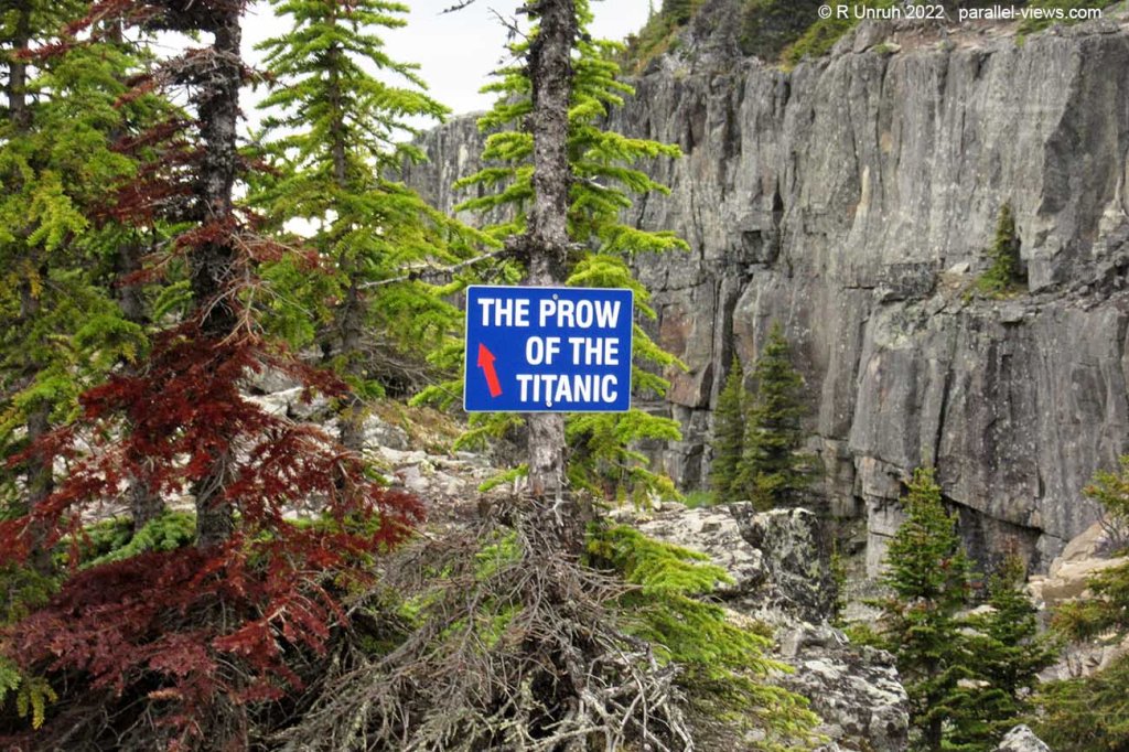
It turns out that the Titanic isn’t on the ocean floor, it is in the mountains! That would be why it was so hard to rescue the survivors! AND I DISCOVERED IT, Not Robert Ballard! Now who’s the world-renowned explorer, and who’s a waste of space who needs to move out of his parents’ basement? So there, MOM!
Not only that, but on the way to the Titanic, I had to pass by another shipwreck,the Bismark. According to the ‘mainstream historians’, this shipwreck was found by… Robert Ballard again? I think this guy must be part of some big subnautical conspiracy. I’ll get into that soon, but first
The trail starts at about 1600 metres above sea level, near the town of Tumbler Ridge. Actually, the adventure started sooner, on the road to the trailhead. The Core Lodge Road is a dirt/gravel road, actively used by a nearby mine. As I went there after a rainstorm, it wasn’t really a dirt/gravel road so much as a mud/mud road. That was probably the worst part of the expedition, as my car really isn’t built for off-roading, and the road, ironically, could be considered off-roading after the bad weather.
However, the trailhead itself is easy to spot, and there’s even a trail map on the sign at the parking lot to make it easier to navigate.
….no, no, there definitely is a sign and map. I took photos.
…yes, I DID discover the Titanic myself. I’m using ‘discover’ in the classical European sense, meaning that it was well known before I found it, but I couldn’t find specifically who discovered it. Therefore, it was not ‘discovered’ yet, and I might as well take credit for being the first. No one else claimed it, after all!
There’s a brief description of the trail, with a paragraph explaining the name of the trail:

Annoyingly, the camera artifacting created an obvious error that makes the text look wrong. I helpfully corrected it here using cutting-edge algorithms:

… and now the sign is accurate.
Like I said, there’s a map too. Here’s the map:

And here’s my route(according to my GPS).

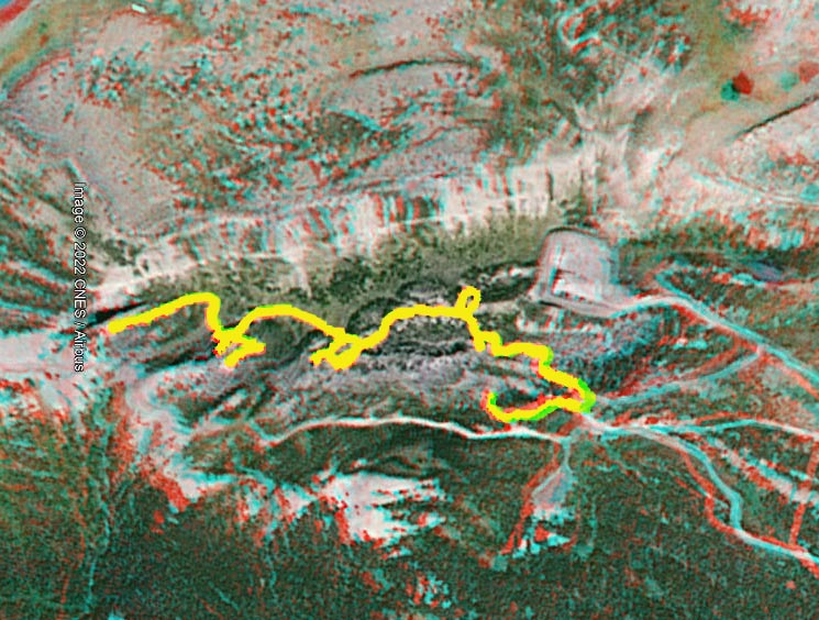
It’s fairly close to the official map. I missed the ‘waterline’ portion of the trail, and somehow made a circle route for Chockstone Ridge, but it’s fairly close.
The hike itself is fairly easy… I mean, it was fairly easy if you have good balance and even better shoes, as there’s a bit of scrambling over rocks. Nothing too bad, unless your expensive camera filter falls off midway and you have to try to get off the trail under a small footbridge and reach through a gap in the boulders to lift up another boulder to get to it. Hypothetically speaking.

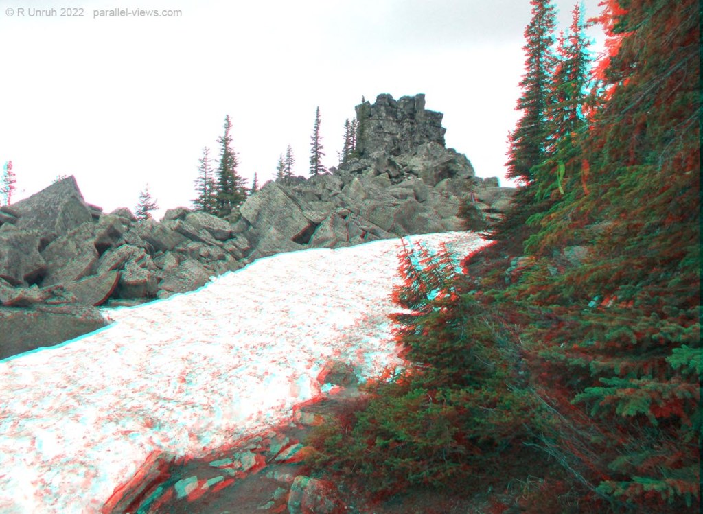
The weather is colder at a mile above sea level, so even on July 2, the trail passed over remnants of the iceberg that sank the Titanic:
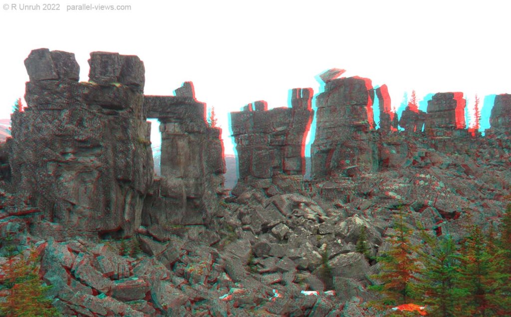
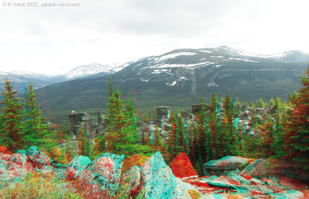
As the map shows, the first major marker is the ‘Armada’. It’s a bunch of small ships that sank near the trailhead. All these ships were made of stone, and to the inexpert eye, someone might think that they’re sandstone columns that broke away from a larger formation. But nope, as an expert, I can confirm that they are all, without a doubt, sunken ships. On a mountaintop. A mile above sea level. Trust me.
The main trail climbs higher past this viewpoint, giving a view of the Armada below.
Beyond here, the path levels out for a while on the way to the Bismark. It doesn’t quite reach the alpine region, but edges fairly close to it. There are trees, but they’re sparse and with a lot of meadows interspersed. It’s a high sub-alpine ecology up here.

And of course there are a lot of rocks. These ones aren’t named, so I can state that they are rocks, not sunken ships. I know… It’s hard to differentiate the two.
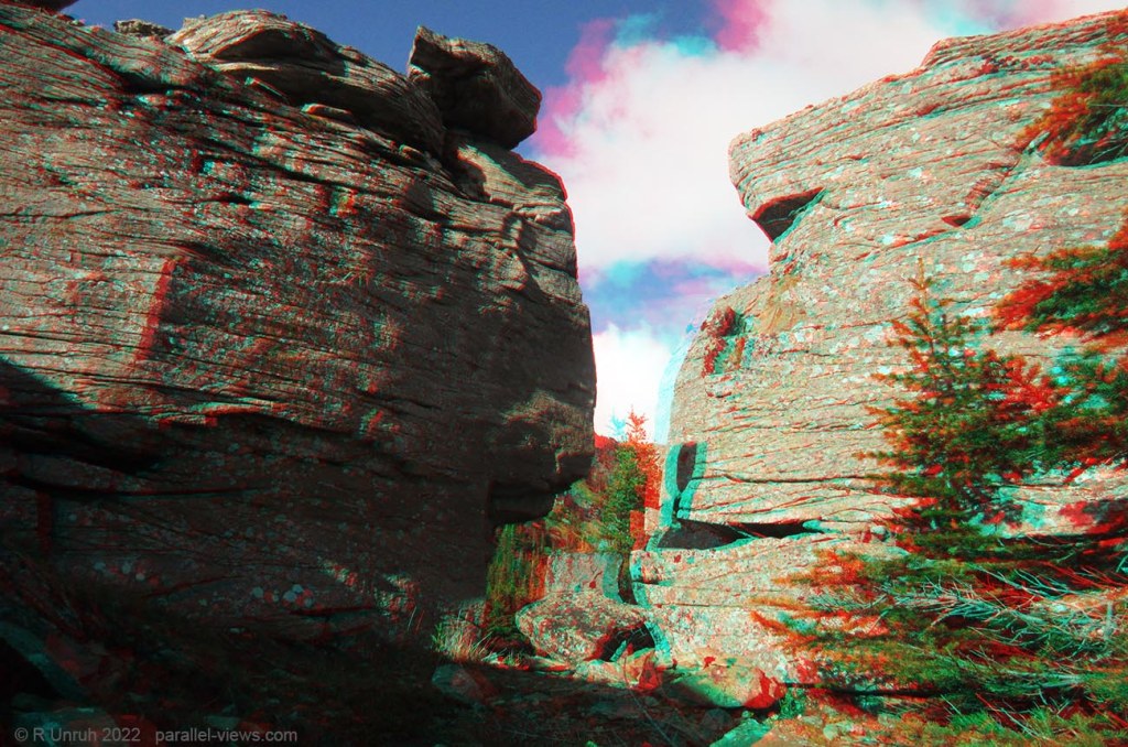
The Bismark is the second stop on the trail(Actually, according to the map, Chockstone Ridge is, but I visited the Bismark first. It looked like I’d only have a brief period of sunny weather, so wanted to push ahead for the view). Here is the Bismark pillar on the right side of the photo.

It looks a little steep. A little too steep for me to climb; I’m not a fan of heights. I’m afraid that although I discovered it, I wasn’t able to ascend to the top of the shipwreck.

Still, the ridge to the left is surmountable, and walking to that edge…

… gives a good view of the Bismark from above.

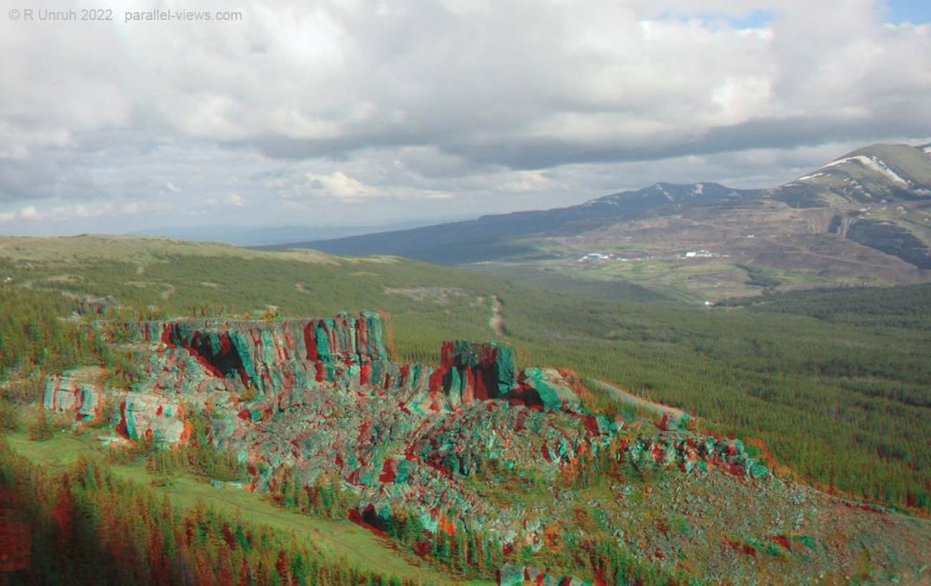
By the way, I did visit Chockstone Ridge on the return trip, and there’s a good lookout there that shows the Bismark from below(on the top right of the photo):

From the Bismark, it is another ascent to reach the Titanic. Again, not difficult, but you want good shoes. I got wet feet, and I didn’t expect to get wet finding shipwrecks!
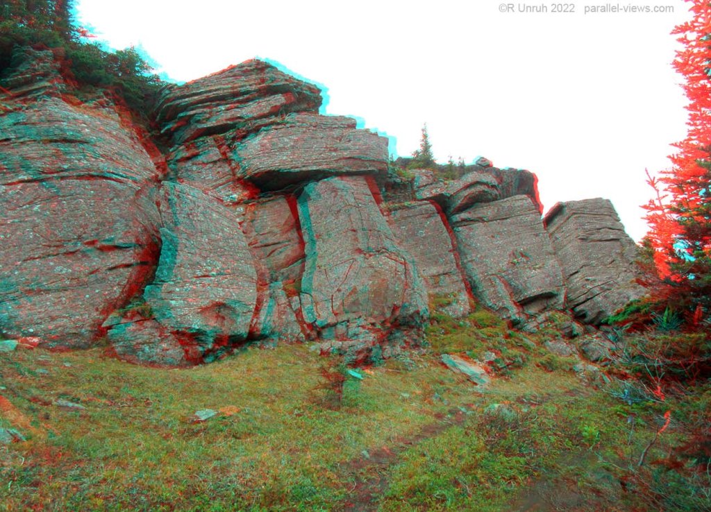
The final trail leads to the edge of the Prow of the Titanic. It the column starts off fairly wide…

…but narrows towards the edge.

There are metallic rings embedded into the edges here and there. I know they’re just mooring rings to help the Titanic safely berth, but if I didn’t know better, I would think that they were used by rock climbers attempting to ascent the Titanic the hard way.
The edge of the Prow of the Titanic is cracked and uneven:

So I only went about as far as where I took this photo. That’s probably why it sank. Looking back from this point:

That’s my walking stick on the large boulder, by the way. Why should I bring something to help with balance when I’m walking a narrow ledge with instant death on both sides?
The rock wasn’t just a goos spot to rest my equipment, but also was a good spot to set up my camera and take a photo of myself:

From this point, there are good views all around. My hunch was right, too: the sun came out for a few minutes while I was here. The sun was in the perfect position so that it illuminated the the Bismark and associated ridge.
… and then it became cloudy again.

… but at least I had those 10 minutes of sunlight! It was time to wrap up my exploring and head back, and …
Wait. What did you say? What the &*!$ are ‘Tarn and Towers trail’?
… look at the map? Okay.

Oh. That.
It turns out that there are two trails from the parking lot. The Shipyard and Titanic trail is fairly easy in my estimation… but Tarn and Towers is REALLY easy. It’s flat, less than half a kilometre long, and there aren’t any big drops.
The trail starts by crossing a small pond. Actually, I guess it’s the ‘tarn’, which means a small mountain lake. But lets be honest. it’s a pond. A pond with a small bridge going to a small island.

Or, if you don’t want to explore the island, you can continue along the trail to see the ‘Armada’ from below.


And that’s it. I took most of these photos with my dual Kolari Pocket cameras, so finally put them through their paces( I did take a few with my canon SX600 HS cameras too). That doesn’t matter. Importantly, this short trail offers definitive proof of the great transoceanic conspiracy that I discovered. This is going to shake you all to your core, so…
Hang on. I’ve got a call from a ‘R Ballard’. Be right back.
….
THIS CONVERSATION IS OVER NOW. GOODBYE
