Jasper National Park, in western Alberta, has some of the best mountain views in Canada, in my opinion. Any visitor absolutely has to drive the Icefield Parkway (Highway 93) into Banff National Park, to the south. There’s a reason the parks are World Heritage Sites.
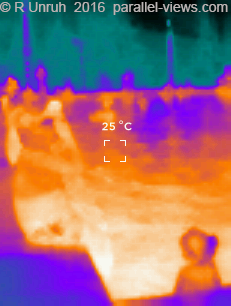
On the eastern side of Jasper National Park is Miette Hot Springs, a developed hot spring pool that is about a 20 km drive off of Highway 16. The road is very narrow, with many sharp corners and hills- it might take longer than you think to reach the parking lot. The springs at the end are popular, and there is a large parking lot for visitors(including RV parking). The hot pool is seen below, as taken with my Thermal Camera using both the black and white setting and one of the colour settings. I was comparing the two, and I found that Black & White seemed to be more detailed:

The cold pool(seen here, with me in it) is completely unheated.

Bighorn sheep can often be seen around the area. There are a number of trails starting at Miette Hot Spring; one, a very easy stroll called the Source of the Springs trail, passes through the ruins of the original hot spring public building, before reaching the source of the springs. The trail is about a kilometre long, with very easy inclines. This is a small trickle of water, flowing over yellow sulphur residue. Here it is with visible light:
and thermal:

For the more adventurous, The Sulphur Skyline trail is a moderate hike that can easily be completed in less than half a day. This hike also starts at the Miette Hot Spring building, but is a completely different route. The trail is about 5 km long each way, with a 700 metre elevation gain. At times, it is a bit of a slog, but there isn’t any really dangerous parts. Near the top, there is a great chance to look back at the Miette springs and parking lot; note the trail line on the bottom right: At the top, above the trees, is an amazing view of mountains in all directions.looking back the way you came, you see:
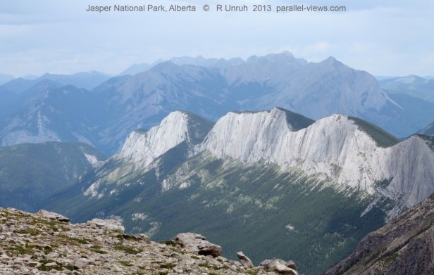
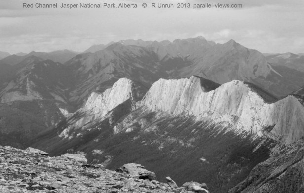
I’m including the separate colour channels again; I thought the last time I did so, it helped clarify the difference between visible and near infrared light. So, in order, the blue, green, and red channels: 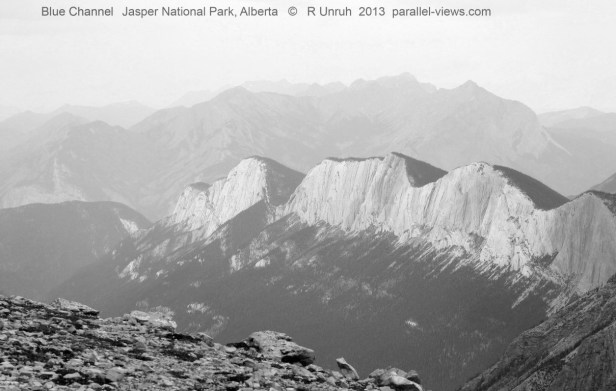

It wasn’t a hazy day(what looks like haze was actually fog and/or rain, which has different effects on the visibility), so there was less difference between the channels than other times.
The infrared photo was taken with a 720 nm lens filter. This is just below the visible spectrum; in fact, if I hold the filter up to a bright light, I can still see it through the glass. 720 nm still allows the camera to register some colour. Depending on how the white balance is set, the colour can vary. I used a white piece of paper, like usual. This photo was taken in a different location than the other ones, as it started raining as soon as I took the previous photos. I walked further while waiting for the rain to pass.
That’s the view looking back. The best view, in my opinion, is in the opposite direction, looking from the end of the trail further to the mountains. After the clouds, the weather cleared up enough to get some great photos.

Again, the blue, green, and red channels:


Finally, another 720 nm infrared photo:
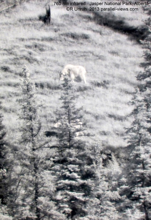
Finally, on the way back, several mountain goats were grazing up one of the slopes. I took a photo in the visible range(I’m not splitting the channels this time) and the infrared. Again, the pictures weren’t taken from the exact same location. This time, blame the goats, not me: when I had the second camera ready, they had moved behind the trees, and I had to adjust my position.