Wells Gray Park, in East-central British Columbia, is one of the Province’s largest. It covers 541 416 Hectares, and can be accessed from two highways(highway 16 on the west side of the park, and highway 5 on the east side and south side). Wells Gray is on the edge of a 300 000 year old volcanic plateau, and the volcanic activity resulted in very unique geology.
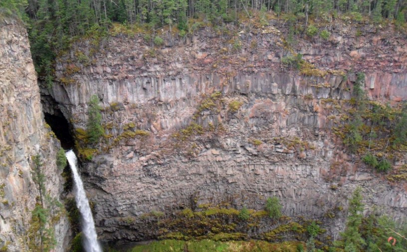
The park contains many waterfalls; Spahats Falls is the easiest to access. Spahats is a first nations word for ‘black bear‘ (from the Thompson Indian band, which I believe uses a dialect of the Shuswap Language). The falls are only a short drive from the town of Clearwater, on Highway 5. From the parking lot, it is a short(less than five minute) walk to the lookout. Originally, Spahats Falls was a separate provincial park, but when Wells-Gray expanded, Spahats Falls Provincial Park became part of the larger park. The falls themselves consist of Spahats Creek flowing through a very narrow canyon before falling over the edge; The lip of the falls is where the canyon opens up into the valley. The falls are about 60 metres high.
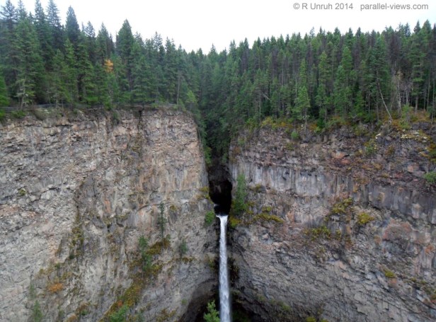
Here is the falls in the visible spectrum;
And here it is divided into the red, green, and blue channels.


The yellow tree(these photos were taken in mid-autumn) in the top left is only apparent in the green and red channels; with the blue channel, all the trees look the same. Even in the green channel, it doesn’t stand out strongly.
These next photos are in portrait orientation because… well, I just liked them better. With no filter on my camera, the full spectrum photo looks like this:

The yellow tree still looks brighter, but once the infrared light is added to the red, it is less apparent. A yellow tree looks less obvious when it is surrounded by brown/yellow trees.
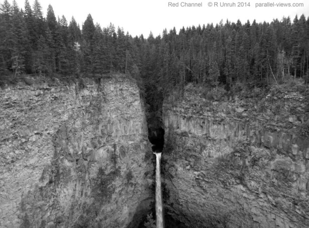
In the 760 nm infrared range, the trees are all bright ‘white'(because of how I set the colour balance, of course). They all look the same; this photo looks almost like a winter shot. The infrared photo is the best at distinguishing the foliage on the cliffside from the actual rock; it is easy to distinguish the bright white of trees and mosses from the darker volcanic rock.
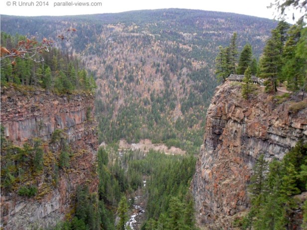
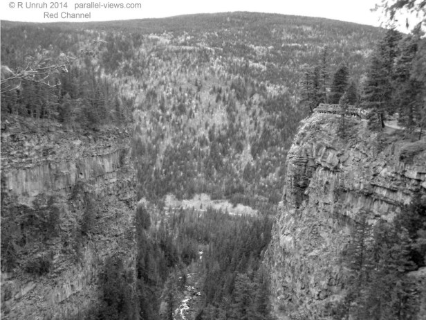
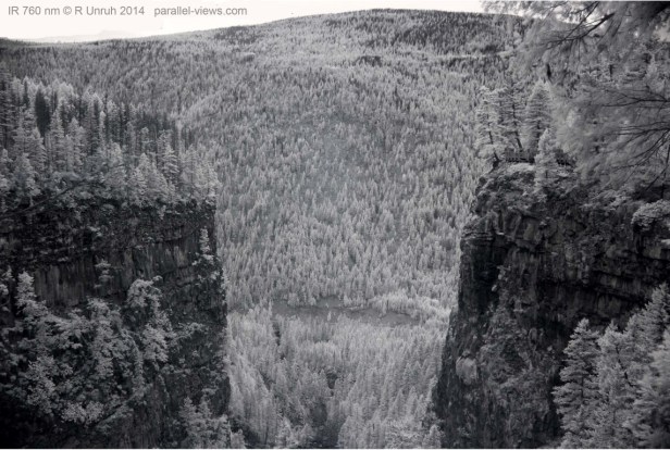
Looking in the other direction, you can see the canyon open up into the Clearwater River Valley, where Spahats Creek joins the larger waterway.
On the the top right, on top of the canyon, the viewing platform is visible; that is where I took the previous photos. These photos are taken above the waterfall. Again, I’m breaking the visible spectrum photo into the red, green, and blue channels. There isn’t really much to mention that I haven’t covered in previous posts, so I’ll just present the pictures.


In the full spectrum photo, the trees return to their bright brown colour.
 And finally, another 760 nm infrared photo.
There are many other waterfalls in Wells-Gray; I’ll post photos of them sometime in the future. Spahats Falls isn’t even the largest falls in the park; that honour goes to the much larger Helmcken Falls.
These photos were taken with a modified Canon Rebel t3i camera. The infrared photo was taken using a Zomei 760 nm infrared filter.
