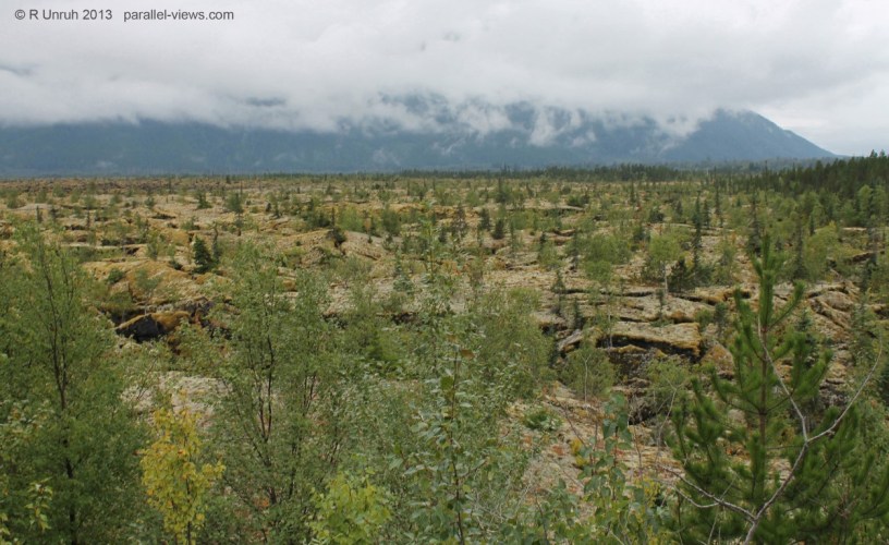
Nisga’a Memorial Lava Beds Provincial Park(Anhluut’ukwsim Laxmihl Angwinga’asanskwhl Nisga’a in the Nisga’a Language) lies north of Terrace, in northwestern British Columbia. The park lies in the Nass Valley, and consists of large fields of volcanic debris, partially covered by moss and vegetation. The damp pacific climate has worked to help plants regrow in the fields; there is more vegetation on the lava beds than in the much older Craters of the Moon National Monument in Idaho.
The Lava flow dates to about 263 years ago. The Nisga’a first nation’s oral history tell of the lava flow; according to their accounts, the eruption of the Tseax Cone resulted in the destruction of two villages, and killed about 2000 people. Other than the oral histories and legends, not much remains of the villages. The park lies within Nisga’a lands, and is jointly maintained by the provincial government and the Nisga’a governments. Four Nisga’a villages lie outside the lava flow, and an interpretive visitor centre is at the park campground.
I mentioned the damp climate: The park is one of those places where I’ve visited multiple times, and yet have still never seen it on a sunny day. The Portland Inlet connects the Nass River to the Pacific Ocean, and the mountains redirect the moist air over the lava beds.
The visitor centre is designed in traditional Nisga’a style, but it is a recently built, modern building.
With the weathering of the wood(I believe it may be red cedar, but am not sure), the artwork on the visitor centre has become faded, and hard to see. Here is the visitor centre divided into the blue, green, and red channels.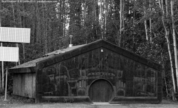
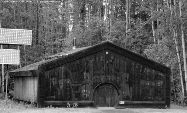

The green channel seems to be the worst at distinguishing the artwork. The blue is better, but red is definitely the best. However, I think Blue might be better at distinguishing the detail within the palm of the hands, as the light shade of the hands in the red channel match the lighter shade of the wood.
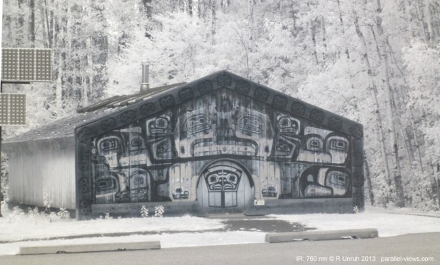
760 nm infrared(using my Zomei 760 nm lens) is the best at viewing the artwork. It is the only photo where the art is clearly visible on the borders of the building. The red paint has a pale tan ‘colour’ with this lens, while the wood is more monochromatic.
This is the only photo I took with a ‘one to one’ comparison to the visible spectrum; I had just started taking near-infrared photos, and hadn’t tried to compare them as often. These next photos were taken in the same area at about the same time, but are not identical. As such, I’m not going to bother splitting the channels for the visible spectrum photos below. All the near infrared photos were taken with the same 760 nm filter I used above.
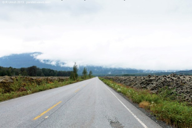

Both of these photos were taken driving north from the visitor centre; paved roads cut through the lava beds, connecting the Nisga’a villages to one another and to Terrace. 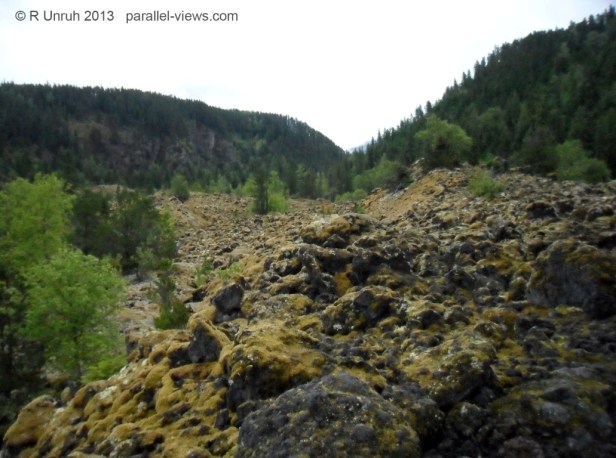


These three photos were taken on a trail at the southern end of the lava beds. The vegetation was about the same in all three photos, with heavy moss and lichens growing on the rocks.
I’ll probably be posting 3D photos in the next post or next week of the park. All these photos were taken with a modified Panasonic Lumix Camera(for the 760 nm photos) or a Canon Rebel T3(for the visible spectrum photos)
