Red/cyan 3D Glasses are needed to view the photos in this post.
The title is a lie. One clue is that Mangroves need salt water, and I’m writing about the interior of British Columbia. The other is that there are no Mangroves in British Columbia, interior or otherwise. We do have rocks, but people tell me that they aren’t very similar to mangorve trees. As I said last post, the Florida mangrove swamps I saw in Florida were strange and impressive, a “floating forest unlike anything I can see in Northern BC”. I lied about that too. Lying is fun. The ecosystem does strongly resemble something from my area of the country, albeit only on a cosmetic and superficial level. Still, I’m a cosmetic and superficial type of person, so I’m writing about it anyway.
Holidays are coming up, so lets talk about traditions first. Traditions are strange, a regular event that people do that make no sense and is objectively stupid. However, people still do them; in fact some might grow until they’re common across an entire culture. When asked why they partake in them, the participants’ only response is ‘Well, that’s the way we’ve always done it’. And maybe the critics have a point: Traditions are inconvenient, pointless, and potentially life threatening.
… Actually, does everyone have to hear that last one, or is it just my family?
I have a tradition, and all the criticisms above could be used on it… and often are. This tradition isn’t annually, or seasonally, and actually isn’t on a set schedule at all, but rather when the conditions all line up… usually once or twice a decade. The conditions include precipitation over the past year, weather over the last month, geography, and water temperature.
Geography first: The city of Prince George lies at the confluence of two large rivers: the Nechako River, flowing east, meets the Fraser River, flowing west. The Nechako watershed upriver covers a vast region; the Fraser, flowing from the Rocky mountains, is the repository of mountain streams and glacier runoff.
Precipitation: Prince George is a day’s drive from the west coast, and isn’t an area with heavy precipitation. The mountains to the east, however, get massive amounts of snow and rain; there is actually a rainforest east of us. The mountains seem to attract rain. And biting insects. Only the former matters for this situation, though.
Weather: Usually, an unusually hot spring is needed. The snow needs to melt quickly.
Water temperature: The Nechako River is usually warmer than the Fraser, and that warmer water is needed… ’cause even with perfect conditions, things are gonna get cold!
So, what do the four of these add up to? If we had a good deal of snow over the winter, and a warm spring, the snow melts quickly. Prince George is prone to floods. The low-lying downtown is on a flood plain. In fact, when the first European explorer, Alexander Mackenzie, came through, he thought the townsite was a lake. In the ’30s, much of the downtown was covered in water. I haven’t seen a flood like that myself(it was predicted for last summer, but it turned out to only be a regular flood…I guess that’s a good thing, but not as exciting). The major factor is that the Nechako and Fraser rivers don’t usually flood at the same time; the Nechako usually peaks in May or early June, while the Fraser is more towards the end of June and beginning of July.
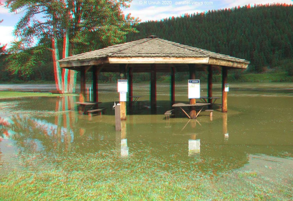
If the Nechako is high but not flooding, and the Fraser is flooding, things get interesting. Prince George’s Cottonwood Park stretches along the river from the conflux to a couple Kilometres kilometres up the Nechako. it is forested with well developed walking trails. There are channels where the river might divert depending on the water level. However, when everything lines up, The Fraser backfills the Nechako River throughout the park. The channels are filled, then the low paths along the river, than the trails However, the water spreads out, and as the Nechako isn’t the main source for the water, the current isn’t very strong through the park.
Look, you all see where I’m going with this, don’t you?
Do I really need to say it out loud?
Yes. I wait for the water to flood the ‘correct way’, and go swimming in the park.
…okay, you can stop criticizing my traditions now. I’m offended. Some wimps people kayak or canoe the park instead, but there’s something surreal about swimming above pathways and trails I know off by heart. The water is often deep enough that I can’t touch bottom… probably over 2 metres(7 feet) deep along the river, and perhaps another metre on the lowest trail(the deepest channels probably are more than 5 metres deep).
And, to be serious for a moment, I do take my safety seriously. I’m a strong swimmer, and am good at reading the water, but I take along flotation equipment, plan my route out ahead of time, know all the trails well, and keep an eye out for any obstacles. Like I said, the current is slow through the park; I can swim again the current without difficulty, and there isn’t much debris floating downriver. If I did need a break, the trees are still there to hang onto. The water is also fairly clean… muddy, but not filled with toxic chemicals and raw sewage. The biggest issue is the temperature… but I’m pretty good at cold too. I mean, I even swam in the Arctic Ocean! I can usually last an hour in the floodwaters before I start to feel cold.
Actually, the biggest issue is the mosquitoes. The flood just gives every mosquito egg an opportunity to ‘live their best life’, even if their best life means sucking very other life dry. I’m usually swimming underwater regularly just to lose them for a few seconds, and I usually look like I have chicken pox from the neck up when I get out of the water.
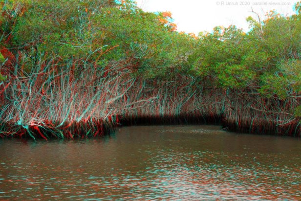
Do they compare to the mangroves? Well, here’s a photo from Florida:
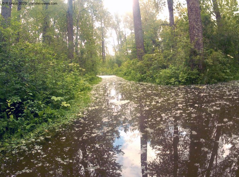
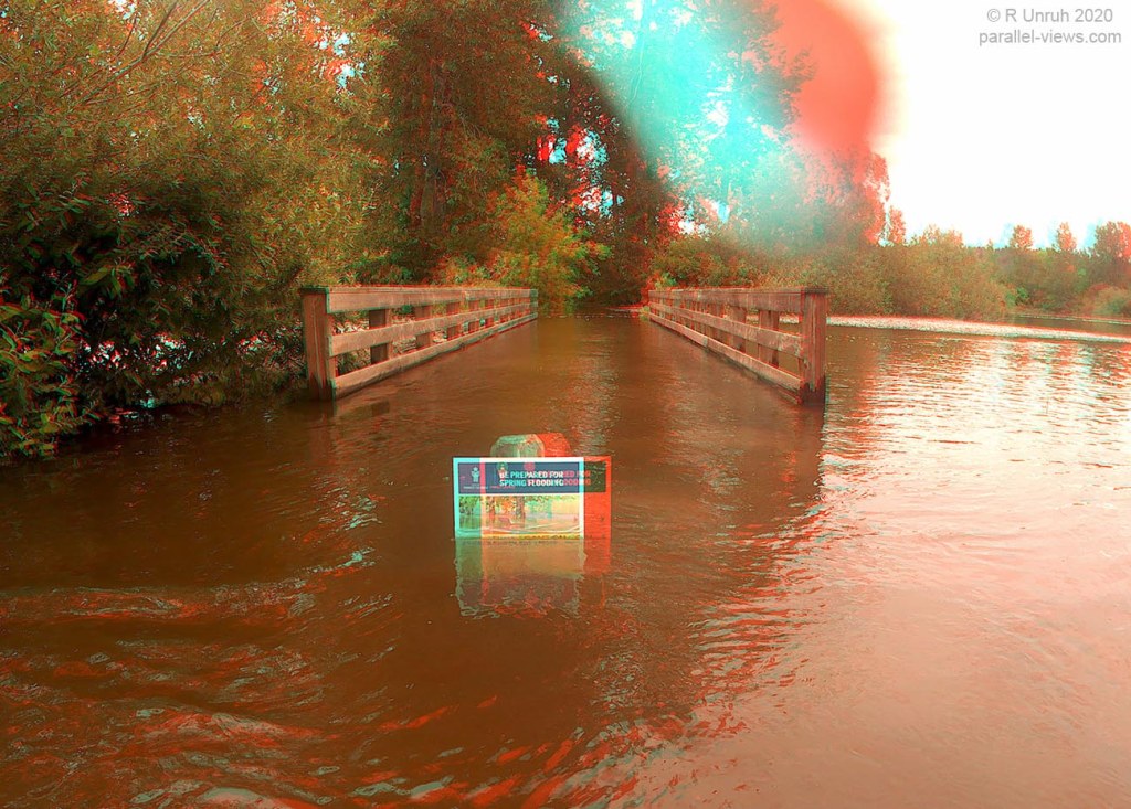
And here’s Cottonwood Park:

There are several parking lots at the park; one gets a bit of flooding, but not usually too deep, another is usually above water…

and a third?
… not so much.
… I didn’t park here, by the way.
I mean, It’s been higher, back in 2007, the ancient days before the Mask People and the great [GENERIC APOCOLYPSE], but still pretty high. It was also higher in the 2007-08 ice jam, but for some reason, I didn’t swim the park that time. To get into the forest from this side, the quickest way is the bridge.
A little worried? don’t worry; there’s a nice bench to sit and get your courage up.

Around here, the water was about waist-deep. It gets deeper in the forest.
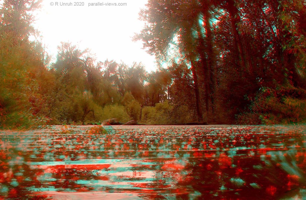
The white fuzz in the forest is seeds and fluff from cottonwood trees. As I said, there isn’t much current, so the white ‘cotton’ covers the slow-flowing areas of the forest. And the trees themselves? they enjoy the flooding. Cottonwood trees are weird. I’ve seen them mostly around rivers up here, but down south, I’ve seen them happily buried in sand dunes in the American deserts as well.

Up here, they grow along the river, and have evolved for the regular flooding. They colonize the banks and sandbars, and stabilize the shoreline until better, cooler, trees take over.

Finally, back on the trail to the upper parking lot. I like to bicycle this trail… I didn’t bring my bike this time, though.
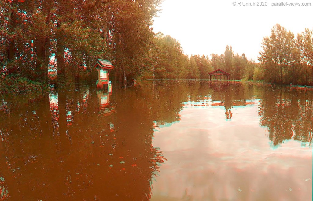
Finally, getting in my car, I decided to finish up with a stop at the downriver end of the park; the city trail system goes under the train bridge, and there is a chainlink canopy to protect walkers from debris.

Other times of the year, I can walk under this and barely touch the top with my fingertips… this time, I can’t even touch the bottom, let alone walk. I can touch the top much easier, though!
In all, it’s a fun tour of a familiar area that has become suddenly unfamiliar. And sure, the water might be cold and muddy, and I might be bitten by mosquitoes and scratched by underwater rosebushes and hawthorns(Oh yeah, I forgot to mention that if you go off the trail, you get gouged by underwater rosebush and hawthorn thorns), but at least up here, unlike the Florida mangrove marshes, I don’t get the feeling that the water wants to eat me.
The above photos were taken with dual Safari 3 action cameras.
