I’ve been under the weather this week, so only one post for the week.
Fraser Lake, in Central British Columbia, flows into the Nechako River, which in turn flows into the Fraser River. There are two communities: The town of Fraser Lake and the community of Fort Fraser(in case you haven’t noticed, Simon Fraser is an important figure in this area of BC).
All these photos were taken along the north side of Fraser Lake, along the unpaved Stella Road. The south side is the main route along the lake for travelers, with Highway 16 being the primary road. 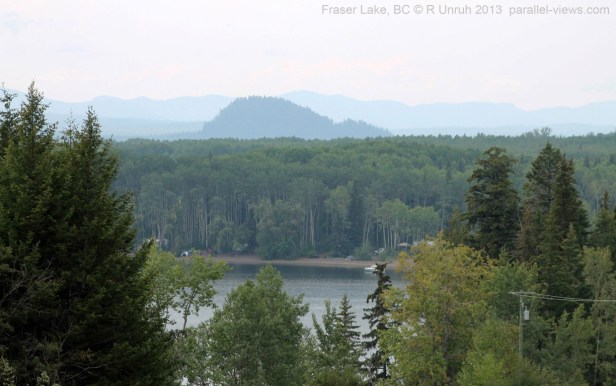
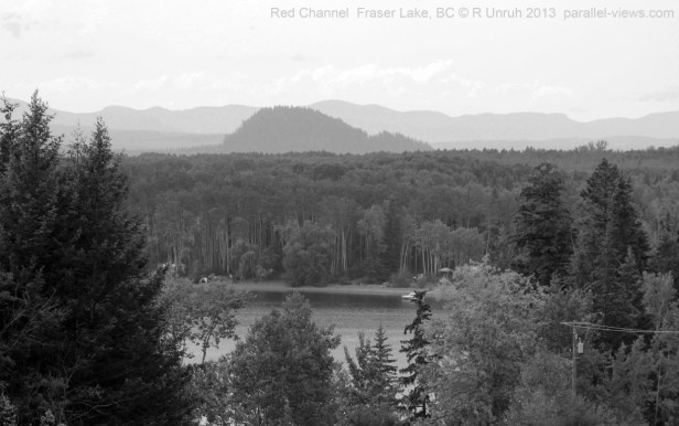
The prominent feature in the first photo is the small hill of Mouse Mountain(which supposedly resembles a mouse). It is on the southern side of the lake, right next to the town of Fraser Lake. Mouse Mountain has several excellent hiking trails(I’ll probably post photos from Mouse Mountain in the future); I believe it is a volcanic plug(not uncommon in central BC), but don’t know for certain. Peterson’s Beach Provincial Recreation Site, along the shore, is a great place to stop of a picnic or a swim.
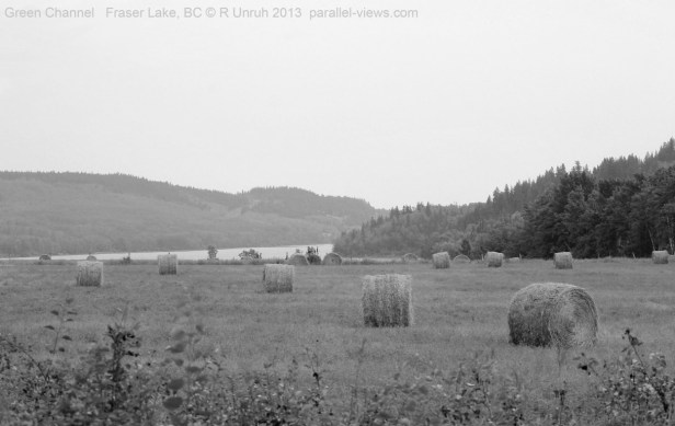
Here is the photo again, broken down into the blue, red, and green channels(in that order).
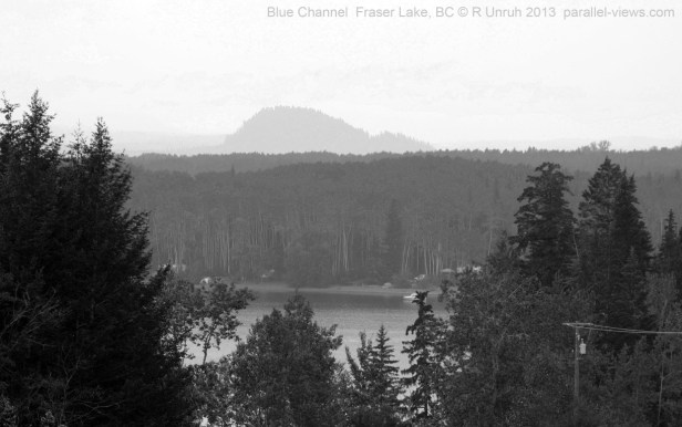
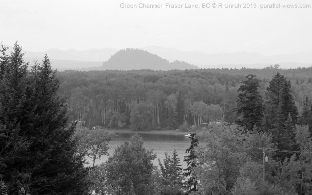
As you can tell, the atmospheric haze is most noticeable in the shorter wavelengths- the distant mountains are not visible in the blue channel, faintly visible in the green, and clearest in red. The difference between the deciduous trees and coniferous trees is noticeable in the red and green channels; coniferous trees are slightly darker. both of these trends continue in the infrared wavelengths, as seen with a 760 nm filter:
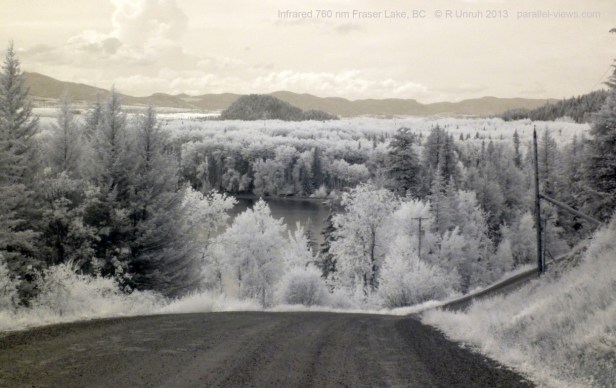
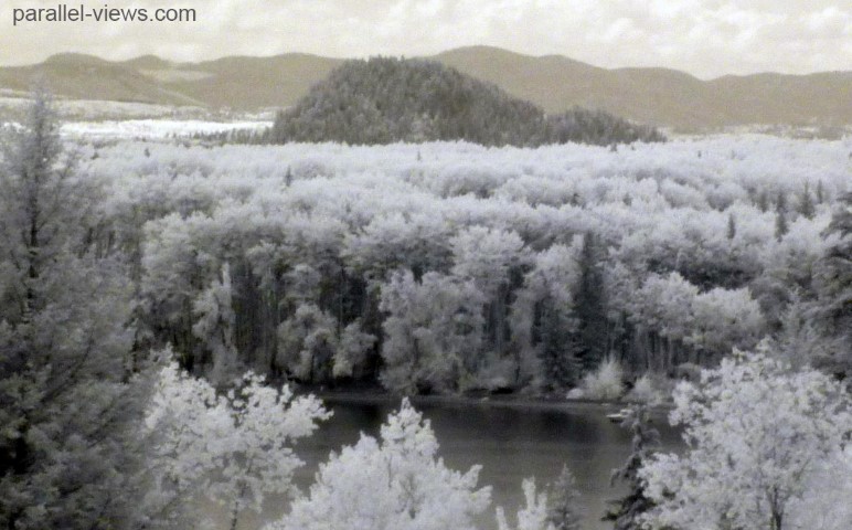
As you can tell with the infrared photo, Mouse Mountain and the hill to the right are both covered in coniferous trees, while the lower areas have only a few coniferous and mostly deciduous trees.
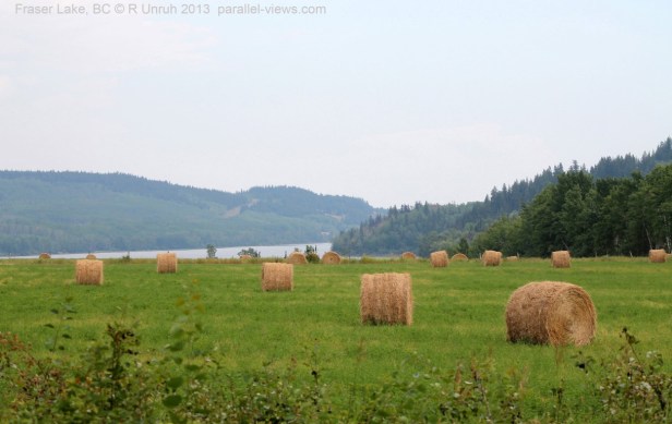
This next photo was taken on the west side of Fraser Lake. The hill in the background on the right side is Mouse Mountain.
Broken into the three channels(in the order of blue, green, and red), the photo shows the same trends as above.

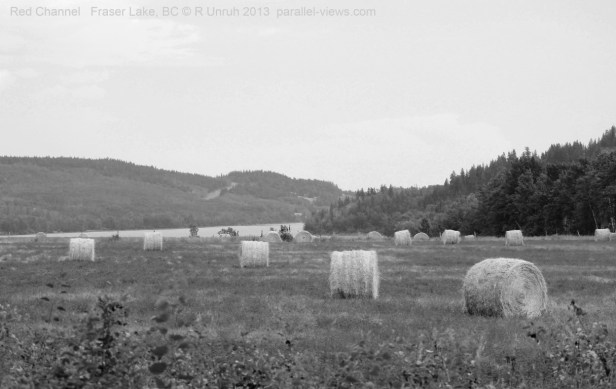
The trends of atmospheric haze affecting the shorter wavelengths, and the difference in tree types is also seen here. As well, all the foreground vegetation is much darker in the blue channel than it is in green or red. because of the atmosphere, the haze in the background of the blue channel acts to make the distant trees seem lighter. Stella Road, seen in the background near the centre of the photo, is only clearly visible in the red channel, and the hay bales are brightest in the red channel, as they have already changed colour after being cut.
This is one trend that does not continue into the infrared range, however.
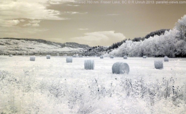
In the 760 nanometre infrared photo above, the hay bales are darker than the surrounding field. The difference in vegetation types is easily visible again, and the background is clear. Stella Road is clearly visible, but as the cut vegetation beside the road isn’t as noticeable in infrared, the road is harder to find in this last photo.
The visible spectrum photos above were taken with my unmodified Canon Rebel T3; and the infrared photos were taken with a modified full spectrum Panasonic Lumix camera and a Zomei 760 nm filter.
