Great Slave Lake is the tenth largest lake in the world, and the deepest lake in North America. And yes, the name is controversial.
Located in the Northwest Territories, only the west side of Great Slave Lake is easily accessible- the proposed road around the east side never came to fruition, as I mentioned before. The entire territory is sparsely populated, with most of the population(including the two largest cities) being clustered around the lake.
North Arm Territorial Park is located on the northwestern shore of Great Slave Lake, close to the community of Behchokǫ̀(Formerly known as Rae-Edzo).

It is just a small park, one of several rest stops along the 220 km drive along Highway 3 between the communities of Fort Providence and Behchokǫ̀. For most of the drive, Great Slave Lake sn’t visible; it is only near North Arm Territorial Park that the lake returns to view.

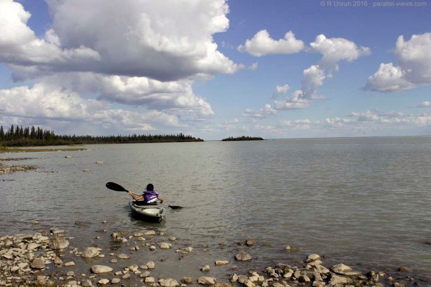
There isn’t much at the park: outhouses, some picnic shelters, a boat launch, and a few interpretive signs about the Tłı̨chǫ first nation. No trails or campgrounds. It is just a good place to take a rest from driving and enjoy the lake. While I was there, there were a few families from Behchokǫ̀ having a picnic- the kids were kayaking along the shore, with some people wading in and out.
My review of the swimming potential at the park… well, it wouldn’t be my first choice. The shoreline is rocky, and it is shallow for quite a ways out(I never got past chest-deep water). It was also fairly murky along the shore, but that may have been the result of storms around the lake. Very calm water, though; no large waves or currents. I had passed through thunderstorms to the south, and would hit more continuing on to Yellowknife, but I had arrived at the park during good weather.

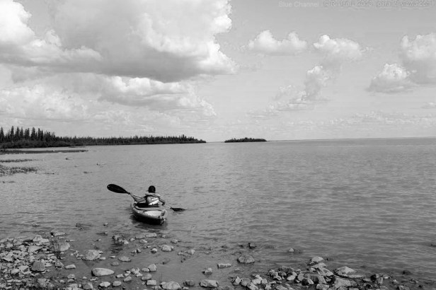
Breaking the photo into the red, green and blue channels don’t show any surprises.


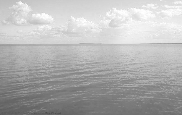
The blue channel is definitely the brightest- the blue sky and bluish water result in a very light photo in blue. As usual, the sky and water is slightly darker in the red channel(and to a lesser extent in the green one), but all three photos look fairly similar. The distant shoreline is visible in all three channels; the atmospheric haze isn’t very strong in the blue channel. As there were no forest fires at the time, and no large population centres (Behchokǫ̀ ‘s population is less than 2000 people, split between two areas), I would assume that the air is fairly clean, with little ozone.
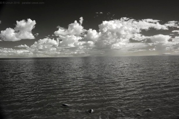
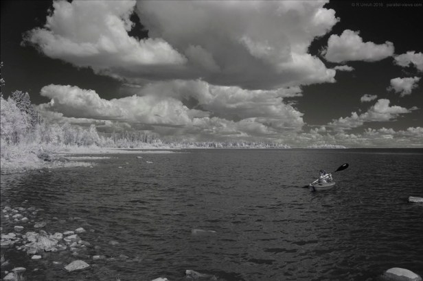
In the infrared spectrum(taken with a Zomei 760 nm filter), the sky is much darker, and the clouds are better distinguished. Rain can be seen on the horizon in this photo, even though it was taken less than two minutes after the visible spectrum picture. The waves are also a lot easier to distinguish in this spectrum.

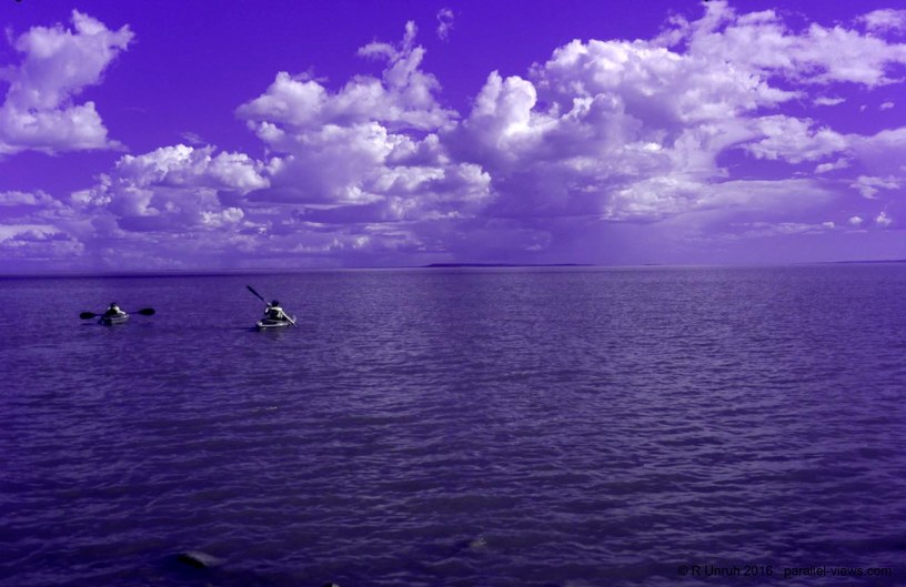
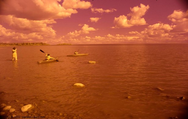
With my Ultraviolet/Infrared dual band filter(a Schott UG11 Filter), the photo is dominated by a dark indigo colour. As well, this filter makes kayakers visible to the naked eye… well, either that, or they paddled into the photo while I changed filters.
Looking north along the shoreline, the flat land on the north side of Great Slave Lake are obvious- in such flat terrain, it seems strange that the lake can be so deep.
The shoreline is visible behind the water as a black line across the photo; the water doesn’t stretch into the horizon.
Breaking this photo into the red, green, and blue channels:


All three channels are very similar; they appear even more alike than the previous visible spectrum picture. In fact, the biggest change between channels is the shades on the kayaker.
In 760 nm infrared again, the far shore is harder to distinguish- the white colours of the foliage match the colour of the clouds.

Back to dual band. With the UG11 filter, the pale green trees provide a contrast to the indigo sky and water. The people, kayaks, and rocks all appear grey; most objects I photograph with this filter appear almost monochromatic. Again, the far shore is a little hard to seen
Before I took the above photo, I made a mistake when swapping filters; I took my first dual band filter photo when the white balance was still set to 760 nm IR. I liked the effect and kept the picture. Here it is; I’m not going to bother analyzing this one, as it IS a mistake.
It has a faded, vintage effect, as if it was taken with an antique camera. Perhaps a bit like a photo taken with expired film?
Anyways, after a snack on the beach, I continued on to Yellowknife, enjoying the beautiful, sunny day.

… at least, for little while longer.
The above photos were taken with a modified Canon T3i camera.
